This walk around the village has been produced by Steeple Aston Village Archive Trust (SAVA). To find out more about the trust and its work, please click here.
There are two pdf versions of this page which you can download and print to take with you on your walk:
Full version including photos
Text only
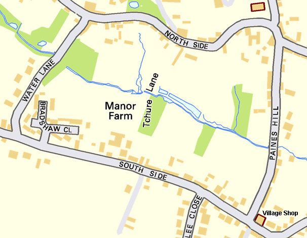
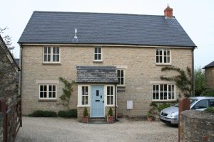
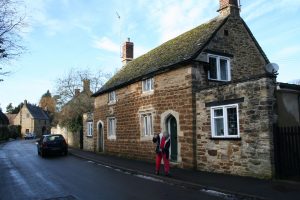
The Village Shop on Paines Hill near the junction with South Side is an easily identifiable place to start a walk, especially if you need a bottle of water or a few sweets to help sustain you on the way.
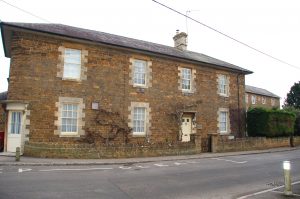
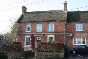
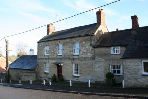
The shop itself is housed next door to the large corner building immodestly called The Old Manor House which was, from 1852 to 1868, a public house called The Wheatsheaf. The original entrance door can be seen set in the corner and above it is an indentation where the sign would have hung. Until recent times, this was the entrance to the village shop – Harris’s Stores, named after descendants of Charles Harris who owned and developed the site in the 1830s and 1840s.
Looking up the slight incline of South Side and down the steeper slope of Paines Hill, you find yourself in the south-east corner of the “green” rectangle of paddocks, orchards and gardens around which the village developed from the 17th century; now the heart of a Conservation Area comprising of houses built from the local limestone and ironstone. The rectangular shape of this oldest part of the village means that there is no obvious “centre”. However, all four corners have significant buildings.
To the left, the aptly named Paines Hill View forms one corner of Harrisville, originally a lane of densely-packed houses built in the 1840s to accommodate farm labourers. Only Four Winds, remains – previously a pair of dwellings. Moving westwards, along South Side, we come to Whitsun House, one of a small number of houses built of brick and initially one of a pair, the other having fallen derelict. Opposite is Bladebone Hall, once known as Town House. The round-headed window and door on the frontage are indicative of the late 18th century.
A few steps further on is the newer Walton House. This was built on the site of (and named after) Walton’s butchers shop which was there, selling prize-winning sausages, until 1998. The Waltons are a family of long-standing in the village with a proud history in the trade.
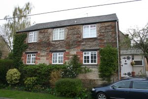
St. Peter’s Cottage, which comes next, was originally two cottages. The bordered sash windows and decorative combination of iron and limestone contribute to its attractive early 19th century design. On the other side of the road there are two newer houses before Compass Cottage, a 19th century building with earlier sections and incorporating an 18th century barn.
Next door is a converted Methodist church, Chapel Hill. The stone plaque outside reveals its 1851 origins. The location of its previously tall windows can just be discerned.
Jubilee Close, built in 1964, runs up the hill to the left and opposite is the entrance to The Old Malthouse and next door Acacia Cottage. Both residences illustrate the changes the village has undergone in moving on from its agricultural past. Part of the original malt house exists behind the later frontage of the present house. Similarly, at the rear of Acacia Cottage, several old agricultural barns have been adapted for residential use. The single-storey building at the west end of Acacia Cottage was once the village reading room. As a general rule, buildings originally constructed for agricultural or industrial use run down the slope whilst most homes are built along the road and across the slope. Note the attractive display of Victorian tiles in the doorway of Jacob’s Croft, previously called The Bungalow but recently renovated and renamed after Jacob Watson who, at the time of the Enclosure Act in 1767, was the owner of this strip of land leading from South Side down to the stream at the bottom of the slope.
The Rise, just after Jubilee Close, has a small early 20th century building on the roadside which has at various times been an antiques shop, a saddlery, a beauty shop and an office. 18th century Orchard Lea opposite was once the home of John Clary who was responsible for laying out the grounds of Rousham House according to William Kent’s designs in about 1760.
On your left, Brunstone, built in the late 18th century, has a walled garden that runs along South Side. Note the ancient insurance plaque on the front of Brunstone, indicating, to any passing fire engine, its eligibility to be saved from oblivion. One of the pair of matching 1860 houses opposite is called Whitestones in contrast to Brunstone. The other is Clare Cottage. 1914 photographs of this pair of Georgian style houses show a set of iron railings supported by the surviving stone pillars at each end, still in place. The railings were probably a casualty of the war effort to provide raw materials for the cause. This was the fate of many sets of railings in the village at this time.
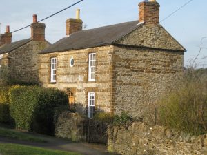
Staithe Cottage was once two cottages. The position of the chimney gives some indication of this and the Stonesfield tiled roof may have been thatched in earlier times. Note how the ground floor is well below street level, indicating changes in level over the centuries.
The same is true for Grange Cottage next door, another 17th century property, situated across the access lane from Staithe Cottage which leads to a row of barns again running down the slope. Grange Cottage is much altered. It was a thatched two-storey house with a pig farm and barns until the late 19th century when the property was gentrified by the Bowyer family, with the addition of an extra storey (note the inverted V of the original roof line on the gable end), rendering on the exterior walls, and landscaping and walling the yard to make an attractive country house. The Bowyer family had once owned the prestigious Grange on North Side and were keen to make known this connection and so named the improved house Grange Cottage. The first floor stone mullion windows date from the 17th century but those on the ground floor are 19th century copies. Opposite is Garden Cottage, owned for a good part of the last century by the renowned Connie Franks, “village woman” and avid gardener whose efforts featured on television and in several coffee table gardening books.
For a diversion, you can take the track up to the left of Garden Cottage for a short way, past two newer houses to Seven Springs, a considerable early 20th century house. The return walk offers a pleasing elevated view over the village.
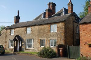
We now come to the pair of cottages on the right, Tamarisk Cottage and Palmer House which are unequivocally dated 1865 but built in the symmetrical style of the 18th century. They stand on the site of an earlier building, the remains of which can be seen on the gable end. Radley Cottage, next, has signs on its gable wall of possibly having once been a single-storey thatched building. The ironstone quoins on only one side indicate that it may have been rebuilt and made two-storey in the 18th century, incorporating the classical style of the time on its frontage.
The eastern section of Greenacres was originally a symmetrical 18th century house which was extended in stages to the west. In front, next to the Tchure footpath are the remains of a pair of cottages demolished in the 1970s.
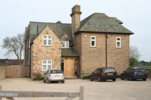
Next, on the right, the barn complex was developed in 2005, a mixture of newbuilds incorporating the latest Eco features in what was the farmyard of Manor Farm. Manor Farmhouse itself has an early 18th century facade, but the off-centre door and lack of symmetry, together with evidence in the roof structure, suggests earlier 16th or 17th century origins.
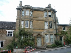
Appleton House which is built in ashlar stone with a string course, dates from the late 18th century. The window high in the gable wall is a feature common to many of the village houses from this period as the steep roof space was often used for living accommodation. In the early part of the century, the house served as the village post office. Major renovations took place in the 1980s and 2013.
The development at Bradshaw Close was completed in 1969 when all but one of the houses was first purchased by the U.S.A.F. at Upper Heyford to house their officers, just one instance amongst many of the influences of the base in the village before its closure in 1993. The village stocks are believed to have been on South Side in this area until about 1860.
Across South Side is a cul-de-sac of individual houses built on a former orchard owned by Jack Wadham who lived at Appleton House. Ahead of you is The Red Lion, the village pub, slightly elevated for a view of the village. The small car park below the steps was once the site of a petrol pump and small garage. Red Lion Corner house alongside was at one time the police house. Late night drinkers were no doubt relieved when it closed.
Now you are at the south-west corner of the green rectangle that is the core of the village. Time for a pint at the Red Lion? No. Of course not! You haven’t walked far enough to deserve it yet! Stick with the water for now and, as luck would have it, Water Lane is the next right turn …
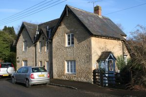
Before turning down Water Lane, take a detour by going beyond The Red Lion on Sixty Foot Road, so called because at the time of Enclosure in 1767, the commissioners laid down that this should be the width of the main East – West road through the village. Opposite Red Lion Corner is a public footpath signposted to the Hopcroft Holt, alongside which is South Side Cottage, possibly a squatter’s cottage from the 19th century and originally thatched. Kiftsgate House, adjacent to it, was formerly The Croft, and originally two cottages and extended around 2004.
Crossing to the north side and walking west from the pub, Hill House dates from early 18th century, was altered and extended in the 19th century and later converted into flats when the estate was broken up and sold around 1960. Plots of land were sold and houses mostly facing on to Water Lane were built. Hill House Lodge was the 19th century gatehouse and the 18th century coach house has been converted into two properties, Mulberry House and The Coach House.
Now turning left at Red Lion Corner you come to Water Lane. There has been a pub recorded in this position from around 1750, originally The Chequers. This continued with a succession of licensees until 1830 when it was sold and renamed The Red Lion. The houses on the left as you walk down Water Lane were built in the 1960s on land formerly in the grounds of Hill House as mentioned earlier. Designed in the modern architecture of its time, the stone used blends well with the village. As you continue up the hill, the woodland garden and pond you see on your left were created by the owners of Kralingen on Fenway in the 1970s and Corner House above stands in ground, which from early 1900s had been the rose garden belonging to The Grange. The group of buildings which form the corner with North Side appear on the Enclosure map of 1767. Randolphs may have been altered from an earlier farmhouse belonging to the Wing family; Wing Cottage and Water Lane Cottage were converted from attached barns in the 1950s.
Before continuing round the conservation area, turn left onto Fenway which, before Enclosure, was a narrow track leading west which villagers had to use to go the long way through fields to Middle Aston as the direct route had been closed off by gates at Middle Aston House. Kralingen was converted from two cottages built in 1916 for employees of The Grange. The next group of buildings, a mixture of conversions and new builds, are on the site of Westfield Motel which was redeveloped around 2008. The cottages along this stretch of road date from the 19th century, many with the name ‘Westfield’, common to several, as this area is where Westfield Farm was located. Westfield farmhouse (now just Westfield) was built in the 1880s so the Wings’ farm could be separated from their house (Randolphs). Westfield farm was then sold to William Fenemore. Many will remember the days when the sound of horses was common in the village, when Westfield Riding Stables operated, now run as a livery yard.
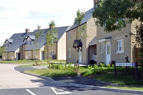
Opposite is Coneygar Fields, a recent development of affordable homes built on land where once horses grazed.
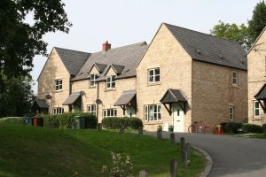
Walking back towards the village, all the development on the north side has taken place in recent years. Shepherds Hill are more affordable homes opened in 2003; apart from the two ex-council houses built in the 1930’s, the other individual properties all date from the 1960s.
The Grange Park estate of 34 houses was completed in 1972 on land formerly part of the Grange estate, evidence of which is found in the number of specimen trees which survive in the grounds and of the gateposts which have been incorporated into the stone wall on North Side. To get some impression of the size of the original estate, take a walk through Grange Park housing estate.
We now return to the conservation area, along North Side.
Looking up from Water Lane the imposing structure of The Grange dominates the skyline with East Springs and West Springs, originally staff housing, at street level. Beneath the high pavement which was probably raised with the construction of these dwellings, is the Town Well which is connected to a spring beneath The Grange. This served as a public well in the days before water was piped into homes and possibly before this may have been a stream which gave its name to Water Lane. All the land on this side of the road behind the tall stone wall stretching to the Almshouses once belonged to the Grange estate. The Grange itself, which would originally have been in a plain Georgian style, was transformed by the mid-1800s by its owner, Thomas Davis IV, into “an eccentric ornamental castle” (Pevsner). Grange Lea was converted from part of the stable block.
As you walk along North Side you can see opposite the development which has taken place over the centuries. At enclosure there was a series of buildings, possibly barns and workshops, alongside the street which have since been replaced by the houses now standing.
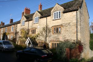
Some of the oldest properties in the village are here with Grooms Cottage, Tangley Cottage, Old Toms and Cedar Cottage all having origins in the 17th century and the other cottages, Holly Cottage, Sunnybank, Wadhams and Tchure Cottage built in the gaps during the early 18th century. During the 19th century many cottages were built in this area, providing homes for rent; the area, now called The Gap, was then known as Burgin’s Rents, named after the developer who also built the White Lion public house. In the 1860s there were 10 households living here but most of the overcrowded cottages have since been demolished leaving only Eve Cottage and Gap End House survivors from this time.
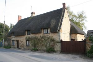
Old Toms and Cedar Cottage are two of the remaining three thatched cottages in the village, both extended in the 18th century. Old Toms came into the ownership of a member of the Davis family, owners of The Grange, as part of a marriage settlement in 1726 and remained in the family through generations until 1813 when it was sold and let to a succession of tenants. (An interesting article can be found on the SAVA website – Love and Bread Making at Old Tom’s).
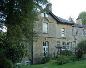
The Tchure, a local name for an alleyway between high walls, links North Side and South Side and probably started as a footpath. Continuing on this side, Cedar Lodge was for many years until the 1980s the home of the writer Iris Murdoch. The present house which dates from late 18th/early 19th century is on the site of a much earlier building, some parts of which may be incorporated. The view which can be seen from the road is in fact the back of the house as the southern elevation is more decorative and looks over the impressive gardens. The present owners have spent the years since moving in renovating the overgrown and neglected garden. Returning to the Tchure, up the track opposite was where the walled kitchen gardens and glasshouses to The Grange were situated and the 19th century Primrose Cottage was home to the head gardener, Dick Wadham. After the estate was broken up in 1951 this area was run for many years as a market garden by members of the Preston family. To the right of the track you will see one of the village’s red Victorian post boxes set into the wall. These boxes were first introduced in 1874.
Next you come to the pair of Almshouses which date from around 1660. Originally these were single-storey and were built using a legacy from the will of Dr. Samuel Radcliffe, the rector of the parish and principal of Brasenose College. During his lifetime, Dr. Radcliffe was responsible for the foundation in 1640 of The Old School which began as a Grammar School for boys when it consisted of one large room with an attic, then extended in 1877 by adding a second classroom behind and a porch. The building continued in use as a school during many educational changes until it was sold in 1969 when Dr. Radcliffe’s school was reorganised to become a voluntary-aided Church Primary School on its present site. The Old School was then converted into a private dwelling. The School House next door was probably built soon after the school but then extended in the 18th century. Until it was sold as a private dwelling in the 1980s, it was still owned by the Dr. Radcliffe’s Trust and rented to teachers from Dr. Radcliffe’s school.
The Church was established at the end of the 12th century when it is believed the nave was built, followed by the chancel and aisles in the 13th century, tower in the 14th century and chancel screen in the 15th century. The former Rectory dating from 1832 and the present 20th century Rectory can both be found up the driveway between Church and churchyard.
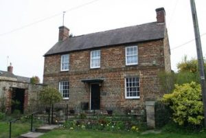
On North Side opposite the church are Rectory Farmhouse and Manor Court Cottage, probably on the site of the original Manor House. There is evidence in the smoke-blackened beams of an earlier medieval hall which would have had a central open fire where the central chimney can now be seen. A number of major changes between the 15th and 18th centuries included the addition of west and east wings which in 1980 were divided into separate dwellings; the west side is now part of Rectory Farmhouse, the east now part of Manor Court Cottage. The 18th century Cedars Barn was converted to a dwelling in the late 1980s.
In the churchyard in Fir Lane can be seen the Sycamore Stone, commissioned to commemorate the longevity of the great sycamore which stood since the early 1800s but which, from 2001, disease and falling branches made it impossible to save. The tree was cut down leaving an impressive stump and a small oak tree was planted alongside. (SAVA holds two graveyard surveys, one of which is still work in progress).
Turning northwards, Fir Lane was formerly known as East Street. Fir Lane Cottage dates from the 18th century with Fir Cottage being attached later in early 19th century. Chancel Cottage dates from late 18th century.
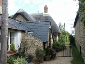
If you turn down the track between these properties you will come to Jasmine Cottage, the third surviving thatched cottage in the village. There may have been more examples of this type of humble cottage in the village in the 17th century and some larger houses may have been built around them. The allotments are further down this track along with other houses built in the 20th century. Windrush, built in 1943, was the head teacher’s house.
After compulsory education was introduced in 1870, further school buildings were required and the building now used as the Pre-School opened as the Infant School in 1872 designed by William Wing the younger. It was followed by that now used as the Village Hall which opened in 1894 as the Technical School. The buildings now used as the Youth Centre as well as others where the playground is now situated were classrooms for secondary age children from the 1920s until Dr Radcliffe’s School was relocated to its present site in 1955.
The area around the Church is where the earliest surviving buildings in the village can be found. The row of cottages opposite the church on the eastern side of Church Corner were once thatched. This was a terrace of 3 or possibly 4 dwellings with origins shown on the 1767 Enclosure map, which were rented until condemned in the early 1970s. In a major rebuild, the roof line was altered, the roof tiled and the building converted into the two dwellings, Merlins and Church Cottage.
Beyond is Cow Lane leading to farmland and a footpath to Lower Heyford. Cottages were added to this older part of the village in the 19th century to fulfill the need for extra housing; in the 1861 census, it was known as Rogers Row after the blacksmith who had built cottages for rent. If you continue along Cow Lane, on the hillside you will see The EyeCatcher, built as a folly designed by William Kent in the mid-1700s to enhance the view from Rousham House.
Paines Hill
It was in the 18th century that the majority of the building took place on Paines Hill following the symmetrical style of the Georgian period. Houses with earlier origins often had their facades altered in line with fashion, with a central front door, upper windows arranged symmetrically with the ground floor and chimneys on both gable ends. Can you recognise these? Most of the dwellings were built in the local limestone and ironstone, but after bricks were produced locally at the brickyard at the bottom of Paines Hill from the 1860s, these were used to build, to decorate cottages and sometimes to ‘modernise’ by refacing stone cottages.
Starting opposite the church and walking downhill on the west side, the first property, the 19th century brick Old Forge Studios has had various uses from a Smithy, a Supermarket from 1961-1984, then offices and, most recently, was converted into apartments in 2009.
A beer house had operated in the adjacent building, now Chestnut House, from 1852 and was known by the name The Dun Cow from 1877. The last landlord from 1924, Thomas Gascoigne, combined pub-keeping with shoeing horses at the adjoining building until around 1960 when the properties were divided and the original pub reverted to being a private dwelling. If you look at the sides and rear of these two buildings you can see that both are stone built so may have had their facades altered.
Further down, Paynes Hill House is believed to have been built in 1806 on the site of the 18th century Fleur de Lys Inn, with its facade constructed from stone and the windows recycled from the recently demolished Middle Aston House. It was sometimes referred to as the Doctor’s house as, from 1902, it was occupied by a succession of doctors. The Georgian cottage on its north side was incorporated and the cottage on its South side is now Hill House. In the 19th century, a brick stable was built, as was Hope Cottage further down the hill. (Further information on SAVA website – articles, Fleur de Luce and the Doctor’s House).
Across the driveway are Barn Cottage and Paines Cottage. Built in 1974, these were constructed from stone from an earlier barn on the site. The Wilkins painting of 1865 shows barns behind these cottages which are no longer in existence. Wickhams is another 18th century dwelling, named after two sisters, Hannah and Elizabeth, who lived there in the 1820/30s. Last on this side of the hill is Silver Springs, a 20th century bungalow built on the site of an orchard. Many of the trees are still producing huge crops of apples.
In 1985 an application was made for planning permission to build a housing estate on the field where we now see rare breed sheep and poultry. This was rejected and the field was bought by the owners of Duckets opposite, so protecting the character of the village.
Walking from the top of Paines Hill on the eastern side, much of the building was done in the 19th century. The cottage which faces down Paines Hill, The Nest, has been in the Stone family since 1933. The following year Mrs Elsie Stone opened a small general store selling groceries, sweets, cigarettes and small household necessities which she ran from a room in the cottage until her death. From 1964-1968 the premises became a baby and children’s wear shop called ‘Kinderland’, which on closure again became part of the private house. At that time two cottages which were standing along Paines Hill were condemned and demolished and the land was bought by Frank Stone who had the front of the cottages rebuilt as a wall. Gwen and Pete Stone then spent years developing the garden. (Further information in SAVA publications – Business and Trade and The Gardens of Steeple Aston).
Next, 4 Paines Hill has been lying abandoned and derelict for many years but the windows indicate renovations had taken place at some time during the 20th century. Audley Cottage possibly replaced two previous cottages shown on the 1881 OS map while Windy Ridge was the 18th century coach-house of the doctor’s house opposite and possibly the Fleur de Lys Inn before it, and now extended. North Ridge, previously known as Minerva House then North Dickredge, is a 19th century former rectory, later extended.
In the 1970s and 1980s, land at the bottom of the hill was developed where the brickyard was once situated, and where High Gable, Hunter’s End and Willow Tree House are now. The stone building on the grass verge is the Coal Barn which dates from 1838 and was used to store coal for distribution to poorer villagers from the Coal Club. This allowed them to pay weekly throughout the year and buy good coal at summer prices.
Around 1860 when the brickworks were still in operation at the bottom of Paines Hill, a pair of semi-detached cottages, Poacher’s Cottage and Brookside, were built to house workers. The unusual style of this Victorian architecture is distinctive in the village.
The Pound House was built in 1976 after proposals by a local builder to develop housing on the Co-op’s orchard with access through common land at the Pound, were dropped after a disputed court case with the Parish Council. The original proposal was abandoned.
As you walk up the hill, the next two pairs of semi-detached cottages date from the 19th century, one in stone, the other in local brick. The Cottage has recently had a two-storey extension added which incorporates part of existing outbuildings. Lidice and Citrus Cottage were built from local brick using different bonds and decorative elements, possibly used to demonstrate the bricklayer’s skill. Next is the 19th century coach-house attached to Duckets with its glass lantern light.
Notice that Duckets has a less steeply pitched roof than some earlier 18th-century properties. The building of the canal and railway in the late 18th-century allowed Welsh slate roof tiles to be transported; because these were lighter in weight, this meant that roofs could be constructed using a lower pitch as it was easier to make them watertight. The last property before reaching the shop is Fenemores, the lower half of which dates from the early 18th century with the section closer to the shop an extension built in the 1980s. An early photograph shows the lower section with a thatched roof and central chimney indicating a pre-Georgian period building. The Fenemore family were pig dealers and occupied many properties in Steeple Aston from 1793 until the end of the 19th century, but there is no evidence that they occupied this particular cottage.
Turning eastwards at the shop into Heyford Road, this part of the village was developed in the 19th century to help cope with the increased population which had doubled between 1800 and 1870.
Beyond The Old Manor House on the corner you come to the building which when built by Charles Harris as his home in 1836 was named The New Manor House. This later became the Cooperative stores in 1872 before reverting to housing after it closed in 1969. Behind is The Old Coach House which was converted to a single dwelling in the 1970s.
Charles Harris was declared bankrupt and his land on either side of Heyford Road, to Lansdowne House and The Old Forge, was sold as building plots in 1843, so dating many of the cottages in this area as well as those down The Dickerage. They are mainly in the earlier Georgian style with windows arranged symmetrically either side of the front door with their lower pitched roofs covered in Welsh slate. Opposite, The White Lion was built in the early 1850s by William Burgin who also built houses speculatively for rent elsewhere in the village. The pub closed in 2012 when it was converted to a private dwelling and renamed White Lion House.
Continuing eastwards, The Old Post Office was in operation in the 1950s. Next to the front door you can see a hatch which was used to deposit parcels outside opening hours. In the mid-1800s, four cottages were erected at the back and rented to families, but they were cramped and overcrowded and demolished in the 1880s. Next you come to The Old Forge where, from 1840, the occupants were wheelwrights and carpenters but they also employed a blacksmith for the metal parts they used. The housing estate Lawrence Fields, built on land which had belonged to The Old Forge, is named after one of the wheelwrights, Lawrence Field. The hedge forming the boundary with Heyford Road was saved after opposition by villagers. When the site was being excavated for the estate, archaeologists found remains of Iron Age settlement and burial pits as well as Roman burials.
Beyond, the War Memorial commemorates the village dead from the first and second World Wars and to where on Armistice Day each year, a procession from the church is held. The remaining development on Heyford Road happened in the 20th century. The privately-owned brick houses, numbers 1-8, were built by a Kidlington firm and have wonderful views across the valley. Much of the building in this area was done by the Council to provide the housing needed after the wars.
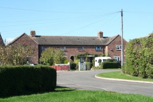
The Crescent dates from the mid-1930s when 24 terraced houses were built to house families displaced when cottages in Harrisville were condemned as slums. Nizewell Head, meaning nine wells, dates the 1950s and the retirement bungalows on Heyford Road from 1980.
The last two properties before the village boundary are examples of individual private development. The Beeches dates from 1908 and is in the Arts and Crafts style of the period. Orchard House was built in 1964.
Further information may be found in the SAVA publications:
- The development of Steeple Aston and Middle Aston
- The Gardens of Steeple Aston
- Business and Trade
- The Steeple Aston Enclosure Map
For details of these and other SAVA publications, please click here.